

Week of July 27: 432 Amazon Earthworks Found by LiDAR, Shroud Dating Reassessed, and More
A LiDAR survey in Acre, Brazil documented 432 earthworks—396 of them newly identified—leading researchers to estimate 24,000–30,000 such structures across the Amazon linked to the "Aquiry civilization." Statistical reanalysis of the Shroud of Turin's 1988 radiocarbon data, released in 2017 following a legal request, revealed inter-laboratory heterogeneity that undermines the original dating's accuracy. Meanwhile, 1.95-million-year-old cut marks at Grăunceanu may push back the earliest European hominin date, and GPR at Hawara revealed an underground grid tied to the Labyrinth complex offset 20–25 degrees from Amenemhat III's pyramid.
A LiDAR survey in Acre, Brazil documented 432 earthworks—396 of them newly identified—leading researchers to estimate 24,000–30,000 such structures across the Amazon linked to the “Aquiry civilization.” Statistical reanalysis of the Shroud of Turin’s 1988 radiocarbon data, released in 2017 following a legal request, revealed inter-laboratory heterogeneity that undermines the original dating’s accuracy. Meanwhile, 1.95-million-year-old cut marks at Grăunceanu may push back the earliest European hominin date, and GPR at Hawara revealed an underground grid tied to the Labyrinth complex offset 20–25 degrees from Amenemhat III’s pyramid.
Dating & Chronology
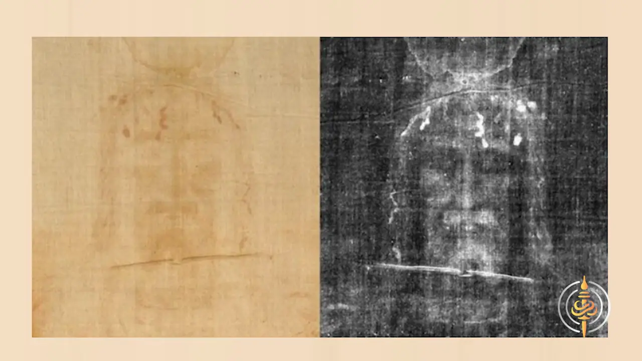
The laboratories returned a calibrated age of AD 1260–1390, yet the raw data behind that result were withheld by the participating institutions for 29 years and released only in 2017 following a legal request to the British Museum.
Statistical reanalysis of the released data revealed the Shroud’s subsamples to be statistically heterogeneous — unlike three control samples — with inter-laboratory differences in means and a monotone spatial variation in ages, consistent with contaminants unevenly removed by differing pretreatment protocols [2]. Data from Zurich and Arizona bifurcate into two groups separated by roughly 100 radiocarbon years, an effect not explained by documented procedures. Two competing hypotheses remain: either an unknown process altered the fabric’s 14C/12C ratios, or non-isotropic contamination survived the pretreatments. Recent reassessments conclude the 1988 dating does not meet current accuracy requirements [1], and the Freer-Waters et al. (2026) study now directly re-examines the original physical textile fragments [3].
Remote Sensing & Technology
Of these, only 36 had previously been recorded through satellite imagery, representing a net increase of 396 newly documented earthworks [V1] [4]. The underestimation by optical methods is striking: in a single deforested section, LiDAR detected 156 earthworks where satellite imagery had identified just 30, roughly a fivefold discrepancy. The survey, carried out in Acre, Brazil, demonstrates how LiDAR’s ability to penetrate forest canopy is transforming the study of pre-Columbian landscapes.
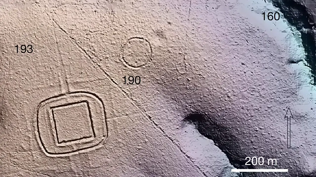
Based on these findings, researchers estimate that the wider Amazon contains between 24,000 and 30,000 earthworks, with roughly two-thirds attributed to the so-called “Aquiry civilization” [V1]. The structures themselves comprise ditches 9–13 meters across and up to 5 meters deep, raised embankments, enclosed plazas, and geometric roads arranged in circles, squares, and complex forms. Most cover 0.35 to 14 hectares, and some cluster into groups of up to eight monuments. They were constructed between roughly 600 BC and 850 AD. Popular reporting has framed these discoveries as evidence of a substantial pre-Columbian society, with derivative population estimates reaching as high as 3 million people [5].
Bioarchaeology & Ancient DNA
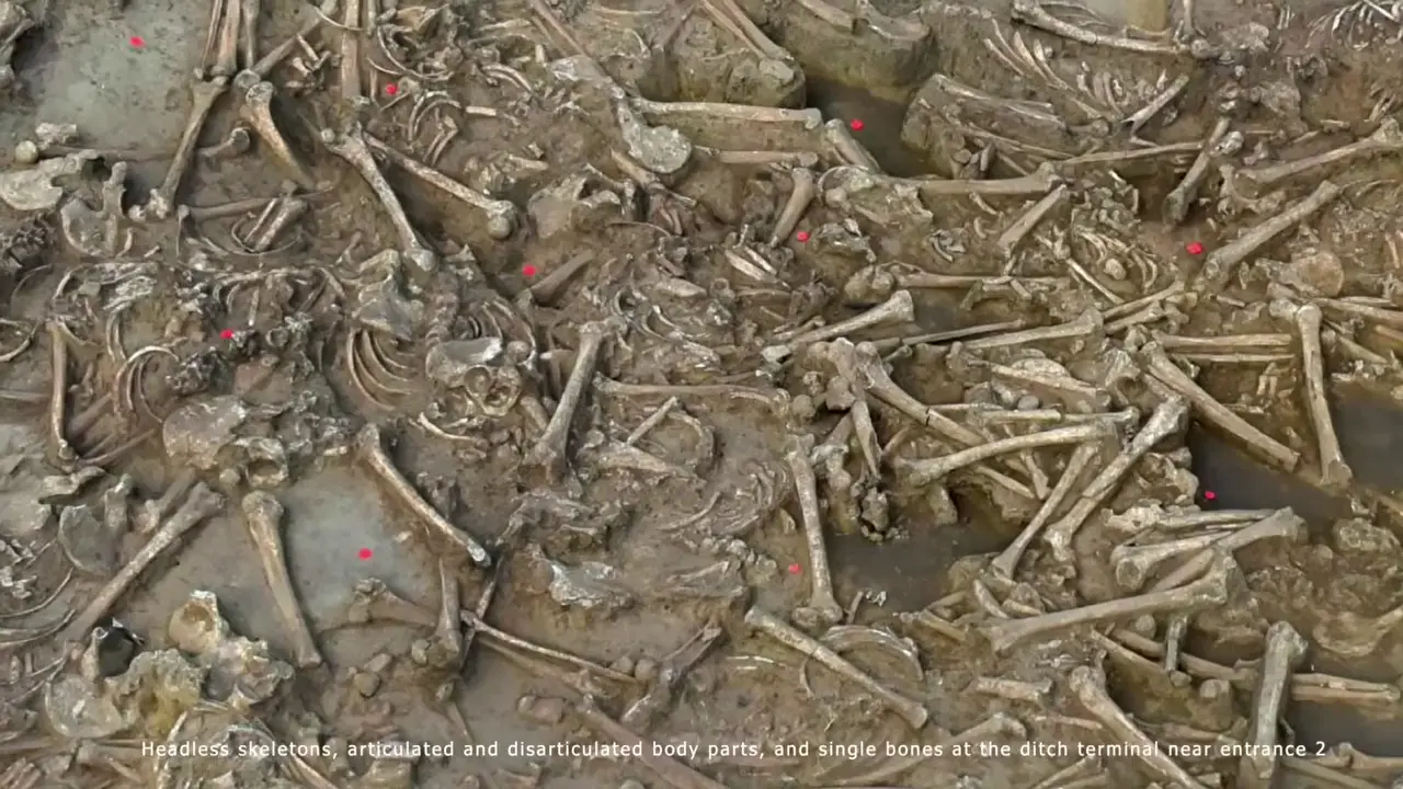
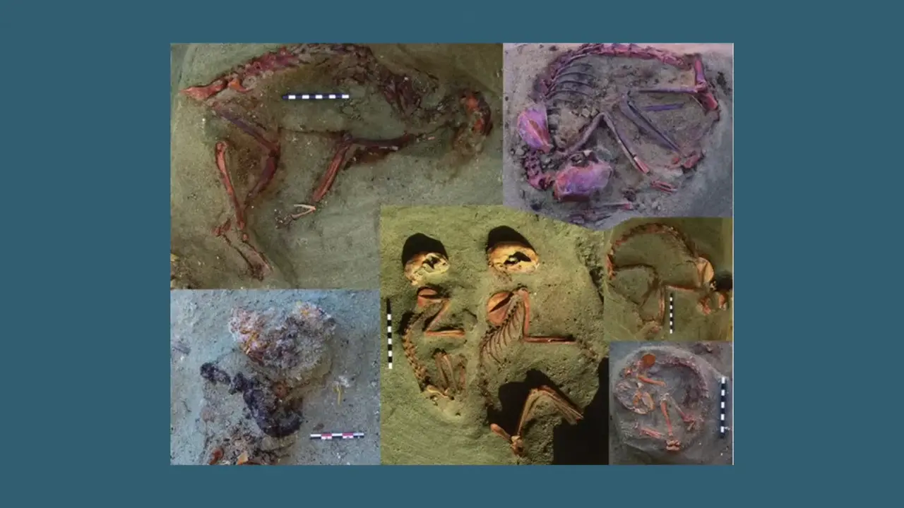
The cut marks on cervical vertebrae identified by biological anthropologist Dr. Katina Fuks are consistent with careful, deliberate skull removal rather than the forceful chopping associated with violent decapitation or battlefield defleshing [V2].
The ditch assemblage contains over 100 individuals in varied configurations—ranging from complete formal burials with grave goods to isolated bones, paired headless individuals, and mixed groups—pointing to a repeated, patterned mortuary practice rather than a single violent event. The deliberate placement of pebbles alongside bodies further indicates structured ritual activity. Social tension at the site is interpreted as emerging inter-neighbourhood antagonism tied to enclosure construction rather than large-scale lethal violence.
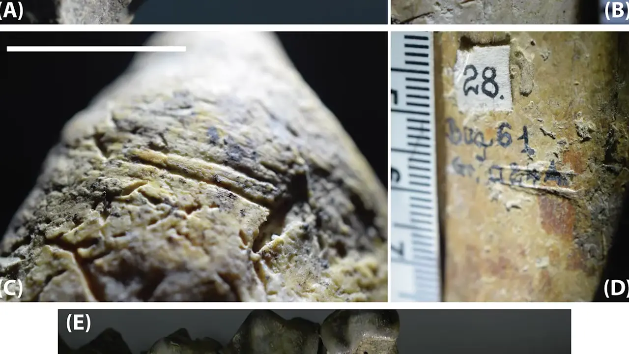
A taphonomic reassessment published in Nature Communications in 2025 by S.C.
The date relies on biostratigraphic assessment of the faunal assemblage rather than direct radiometric dating of the cut-marked horizon, and the case for hominin presence rests entirely on these modified bones — no stone tools or hominin remains have been recovered.
Architecture & Monuments
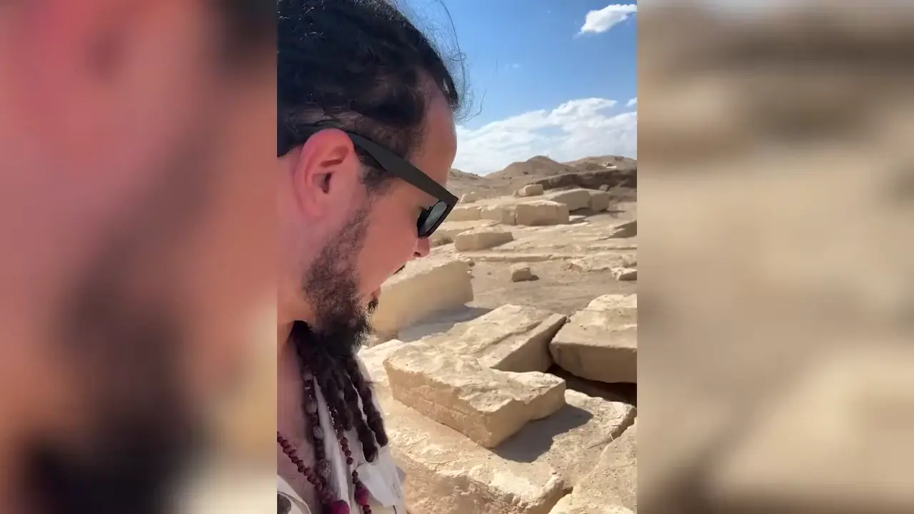
The Labyrinth structure at Hawara is offset approximately 20–25 degrees from Amenemhat III’s pyramid [V3] [7], a puzzling angular discrepancy given that ancient Egyptian monuments were typically aligned with great precision.
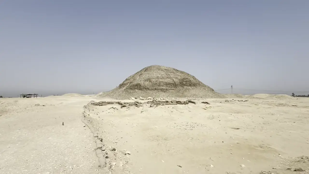
Beyond the angular puzzle, the Labyrinth was constructed south of Amenemhat III’s pyramid, with a cult complex extending approximately 120 metres in that direction [8]. Petrie conducted excavations of the complex, providing the primary archaeological record of the structure [6]. The Labyrinth dates to approximately 1800 BC, during the reign of Amenemhat III (c. 1860–1814 BC) of the 12th Dynasty, and is identified in Classical writing as the legendary edifice described as having approximately 3,000 rooms connected by winding passageways.

The Hoysaleswara Temple at Halebidu, Karnataka, was constructed beginning around 1121 CE under the patronage of King Vishnuvardhana of the Hoysala Empire, making it approximately 900 years old by standard archaeological dating [11]. Its pillars are widely described in art-historical and architectural literature as “lathe turned,” typically featuring circular or bell-shaped cross-sections, with some further carved after the turning process [9]. Many art historians accept the theory that these stone columns were shaped on a lathe, and the pillars do display a rotational symmetry consistent with rotation-based shaping [10]. The temple complex as a whole has earned UNESCO World Heritage recognition for its elaborate stone craftsmanship and hyper-real sculptures.
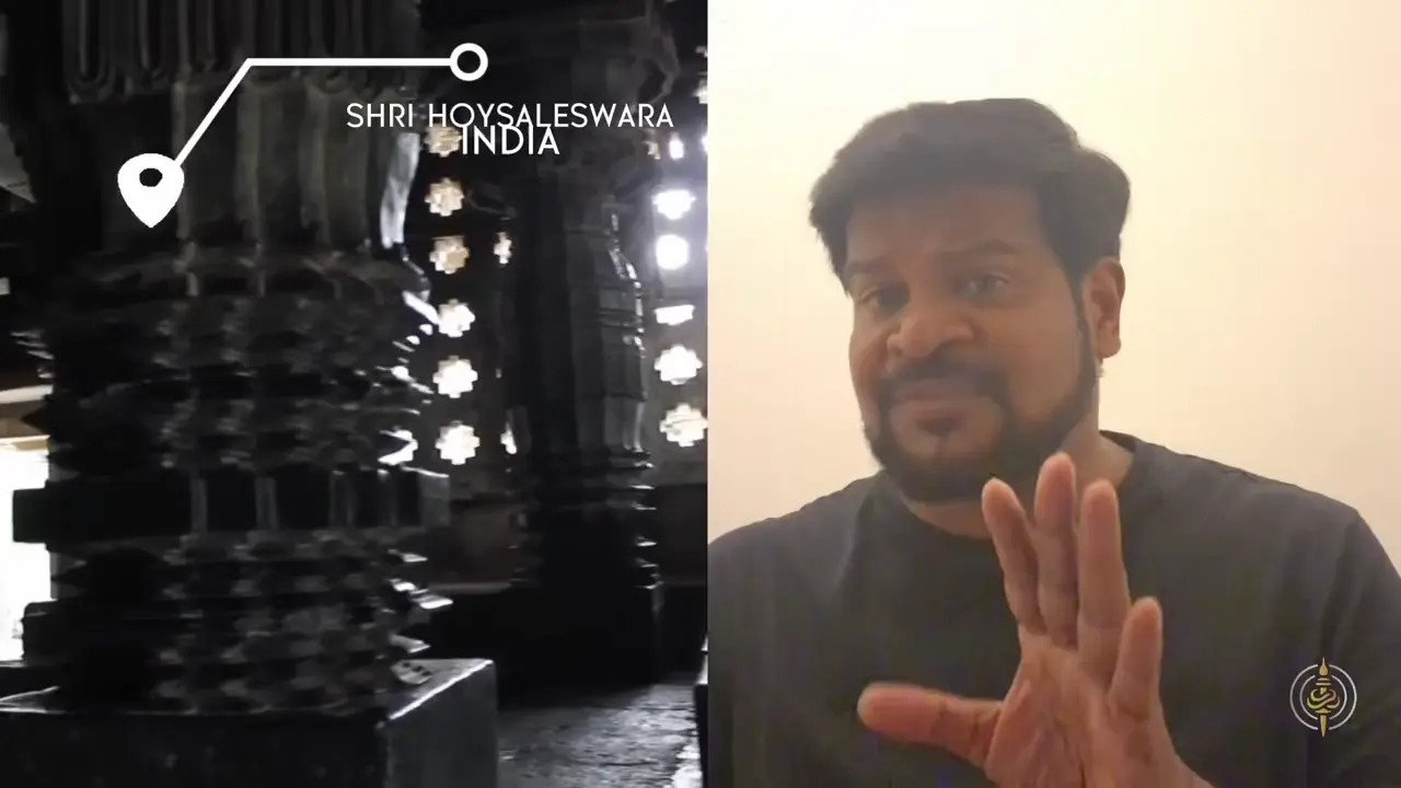
Despite this widespread acceptance, the claim remains notably unverified. Equally important, the physical feasibility of rotating a monolithic stone pillar of the reported scale—weighing several tons—on a period lathe, including questions of torque, bearing loads, power source, and machine capacity, remains entirely unaddressed in the existing scholarship [V4]. The lathe-turning description thus persists as an inherited art-historical label rather than a demonstrated manufacturing technique.
In Brief
Rather than a single terminal conflagration, a new archaeomagnetic investigation documented fire damage at six distinct structures, suggesting repeated episodes of burning over time.
Accumulating evidence is forcing scholars to rethink the equation between fire and civilizational collapse at Teotihuacan. The city likely survived for roughly a century after the last major burning episodes, undermining the idea that fire marked an abrupt end.
The Linear Pottery culture (LBK) has yielded a striking mass violence corpus across Central Europe. Asparn-Schletz in Lower Austria preserved more than 200 individuals killed by blunt force, dozens of them recovered from a ditch, in an assemblage conspicuously lacking young women. Schöneck-Kilianstädten in Hessen, discovered in 2006 during road construction, produced at least 26 victims of similar violence, formally situated alongside Talheim and Asparn/Schletz within the broader Early Neolithic mass violence corpus. At Halberstadt, systematic execution is indicated by targeted blows to the back of the head inflicted on a highly selected, almost exclusively adult male and non-local population [14].

Vráble-Veľké Lehemby in south-west Slovakia fits this pattern, having yielded an Early Neolithic mass deposition of headless human bodies within ditches surrounding the LBK enclosed settlement [15] [13]. It has been directly compared to Herxheim, though social and historical circumstances underlying each appear highly particular [16]. The absence of younger women at Talheim, Asparn/Schletz, and Schöneck-Kilianstädten has been interpreted as a possible indicator that attacking groups selectively captured female prisoners, while the massacres at Talheim and Schletz-Asparn are conventionally read as village-against-village conflict. Commentary has characterised the scale of late LBK killing as comparable to violence seen today only in the most war-torn modern countries [12].
Building L, situated on the western side of Monte Albán’s main plaza, houses approximately 300 carved stone slabs known as the Danzantes — though the term is a colonial-era Spanish misnomer applied by conquistadors who mistook the contorted figures for dancers [V5] [17]. Associated glyphs likely represent the names or “uttering” identities of named individuals.
The display served a clear political-ideological purpose, legitimizing Monte Albán’s authority and intimidating rival communities. These carvings remain in situ only at the Danzantes Wall, which was later built over and modified [18].
These figures derive from standing Buddha types prevalent under King Kanishka (ca.
A bilingual Sanskrit-Greek inscription from 248 AD—the only known Sanskrit inscription to name a Roman emperor—records a kshatriya named Bazula erecting an image, likely a Buddha. Further evidence of Indo-Roman exchange includes a stele depicting Pancaratra figures (Samana, Vasudeva, Ekachamsrana) alongside Satavahana-period Indian coins and a terracotta now recognized as an Indo-Greek warrior rather than a Roman auxiliary. Founded by Ptolemy II Philadelphus in 275 BC, Berenike became a Red Sea trading hub linking the Mediterranean to the Indian Ocean—the cosmopolitan setting in which this Buddhist community took root.
The Gila Cliff Dwellings cave system in New Mexico contains 46 rooms whose ceilings and walls still bear visible fire-blackening from the site’s occupation, and it has been protected as a national monument since 1907 [V6]. A grinding slab found in 1968 predates the dwellings themselves, suggesting earlier use of the area.
The site’s archaeological record has been badly compromised by looting. Numerous human bodies were discovered but nearly all were looted or sold rather than scientifically documented, and only a mummified infant known as “Zeke” remains in institutional hands at the Smithsonian, where it is unavailable for examination. Because looting disturbed the stratigraphy, dendrochronology became the primary dating method, and the National Register form—though heavily redacted—openly acknowledges unexcavated intact deposits in Cave 2 and possible earlier material in Cave 5. A separate 1909 claim by G.E. Kincaid of Egyptian artifacts in a nearby cave led to that site being closed to the public.
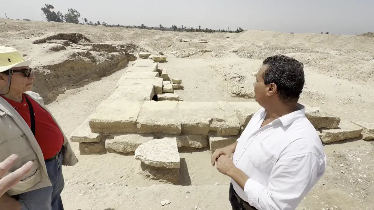
The academic findings were later published by Adam Szynkiewicz of the University of Wrocław on ResearchGate on September 15, 2015, in a paper titled “GPR research around the Hawara pyramid (Fayum, Egypt)” [21]. The GPR investigation focused on the area to the northeast of the pyramid, where comparative photographs taken by Uytterhoeven in 2003 had documented earlier excavation work [19]. Broader GPR-based survey work at the site has revealed an extensive underground grid of walls and chambers interpreted as part of the famous Labyrinth complex, which lies south of Amenemhat III’s monument [20] [22].
Sources
- The Radiocarbon Dating of the Shroud of Turin - PMC - NIH
- Statistical and Proactive Analysis of an Inter-Laboratory Comparison: The Radiocarbon Dating of the Shroud of Turin
- Analysis of textile fragments from the 1988 radiocarbon samples …
- Archaeologists Used Lasers to Find a Vast Engineered …
- LiDAR reveals hidden Amazon earthworks from lost …
- The Labyrinth Enigma: Archaeological Suggestions
- Labyrinth structure offset 20-25 degrees from Amenemhat III pyramid
- A Virtual Exploration of the Lost Labyrinth
- Hoysala architecture
- Hoysala Temples Lathe Turned Stone Precision Ancient Engineering
- Hoysaleswara Temple
- Mass grave reveals organised violence among Europe’s first farmers
- (PDF) The massacre mass grave of Schöneck-Kilianstädten reveals …
- Early Neolithic executions indicated by clustered cranial trauma in the mass grave of Halberstadt
- Neolithic Bodies in Vráble – 7000 year-old Headless Human Skeletons in an Enclosed LBK Settlement in South–West Slovakia
- Structured depositions at Herxheim and elsewhere
- Zapotecs Build Monte Albán | Anthropology
- Danzantes of Building L at Monte Albán
- a Location of the study area in Hawara, northeast …
- Unraveling the Mystery of Hawara - by Louis De Cordier - Labyrinth of Egypt
- (PDF) GPR research around the Hawara pyramid (Fayum, Egypt)
- Labyrinth of Egypt
Videos
V1. Ancient Architects — “NEWS | LiDAR Reveals up to 30,000 Ancient Structures in the Amazon Rainforest” V2. The Prehistory Guys — “Does This Mean There Was a Massacre at Vráble-Veľké 7,000 Years Ago?” V3. Anyextee — “Egypt’s Lost Labyrinth: New Evidence Beneath Hawara (2026)” V4. The Cosmic Summit — “Kailasa Temple Was Carved Out of One Solid Hill” V5. World of Antiquity — “The Rise and Fall of the ZAPOTEC EMPIRE” V6. DeDunking — “The Gila Cliff Dwellings of New Mexico & Archaeology Coverup #realarchaeology #archaeology #gila”
Keep exploring
Every site on this page sits on the globe, and the people who research them are on the Discord.
3D Globe · Sites by country · Story Archive · Research Library · Weekly Journal · Search