

Week of August 17: Denisovan Leg Bones Reveal Exceptional Height, Sayburç Chamber, and More
Penghu 2 and 3, Denisovan leg bones dated to 43,000–45,000 years ago and identified via palaeoproteomic analysis, rank among the largest known from any Pleistocene Homo individual and extend the Denisovan range roughly 4,000 km southeast of Denisova Cave. At Sayburç, a Pre-Pottery Neolithic site in the Eastern Taurus foothills, excavators uncovered a bedrock-carved subterranean chamber roughly 18 by 25 feet with benches and column-like corners, while a 2026 Antiquity reassessment by Aurora Petan argues the contested Sinaia lead plates may constitute a genuine Dacian royal archive. Separately, LiDAR-based estimates place the southwestern Amazon's precolonial population at 1.2–4 million people, and the Great Breach on Menkaure's Pyramid has been dated to between 1639 and 1792.
Penghu 2 and 3, Denisovan leg bones dated to 43,000–45,000 years ago and identified via palaeoproteomic analysis, rank among the largest known from any Pleistocene Homo individual and extend the Denisovan range roughly 4,000 km southeast of Denisova Cave. At Sayburç, a Pre-Pottery Neolithic site in the Eastern Taurus foothills, excavators uncovered a bedrock-carved subterranean chamber roughly 18 by 25 feet with benches and column-like corners, while a 2026 Antiquity reassessment by Aurora Petan argues the contested Sinaia lead plates may constitute a genuine Dacian royal archive. Separately, LiDAR-based estimates place the southwestern Amazon’s precolonial population at 1.2–4 million people, and the Great Breach on Menkaure’s Pyramid has been dated to between 1639 and 1792.
New Excavations & Fieldwork
This Pre-Pottery Neolithic site in the Eastern Taurus foothills, part of the broader Taş Tepeler project investigating mid-9th millennium BC communities, appears to contain yet another example of the subterranean architecture increasingly recognized across the region. The chamber is carved from bedrock and reportedly descends two to three levels below the surface, consistent with Sayburç’s broader architectural practice of carving floors directly into the living rock [V1].
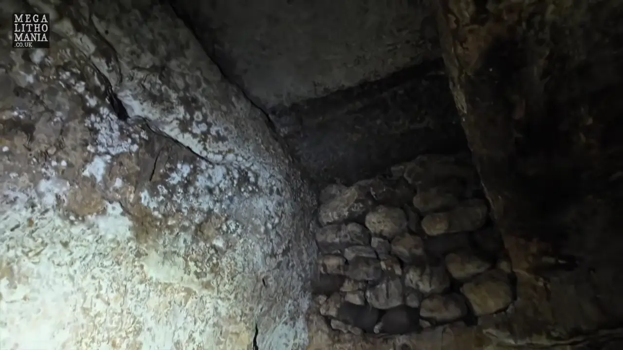
Preliminary interpretations suggest the space measures roughly 18 feet wide by 25 feet, with benches running along its edges and corner shaping that resembles columns, features that align with the documented “special buildings” at Sayburç [V1]. Sayburç has been under investigation only since 2021, and published accounts, including the celebrated narrative reliefs presented across two horizontally adjacent panels, represent early results that may shift substantially as fieldwork progresses.
The newly exposed enclosures follow the general scheme of known Pre-Pottery Neolithic A structures at the site, though excavations remain incomplete [1]. A single presentation has reported the discovery of square, rectangular, and semi-circular enclosures at unusually shallow depths consistent with Layer B stratigraphy, though this Layer B assignment is not independently corroborated by other provided sources.
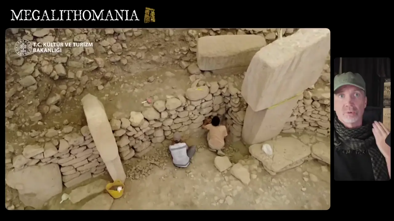
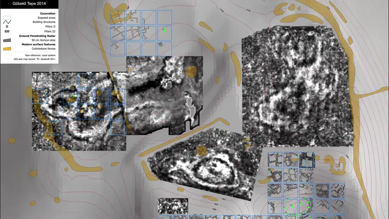
These figures, reinforced by a ground-penetrating radar diagram produced by the German Archaeological Institute, likely derive from extrapolation—combining geophysical enclosure counts with the typical 10–12 pillars observed in excavated examples. Klaus Schmidt led excavations here from 1996 until his death on 20 July 2014, and ongoing work in squares 24, 25, 34, and 35 has already revealed the beginnings of a large oval building comparable in size to Enclosure D. The T-shaped pillars are typically arranged in round or oval enclosures, often with a pair of free-standing central pillars, and are highly probable anthropomorphic representations [2].
Yaxuná sits in the Puuc region of Yucatán, roughly 20 kilometers south of Chichén Itzá and beside the modern community of Yaxunah, and remains a relatively lightly restored site that is nonetheless accessible to visitors. Its architecture is consistent with the broader Puuc style found across this part of the peninsula [3]. In traditional Maya cosmology, caves were understood as physical portals to Xibalba, the underworld known as the “Place of Fright,” making natural and built openings into subterranean spaces ritually and mythically significant [4]. Beyond these basic geographic, architectural, and cosmological points, the provided findings do not contain verifiable details about any specific footage, individual researchers, or documented ritual access at the site, so no further claims can be responsibly reported from this material.

Artifact Discoveries
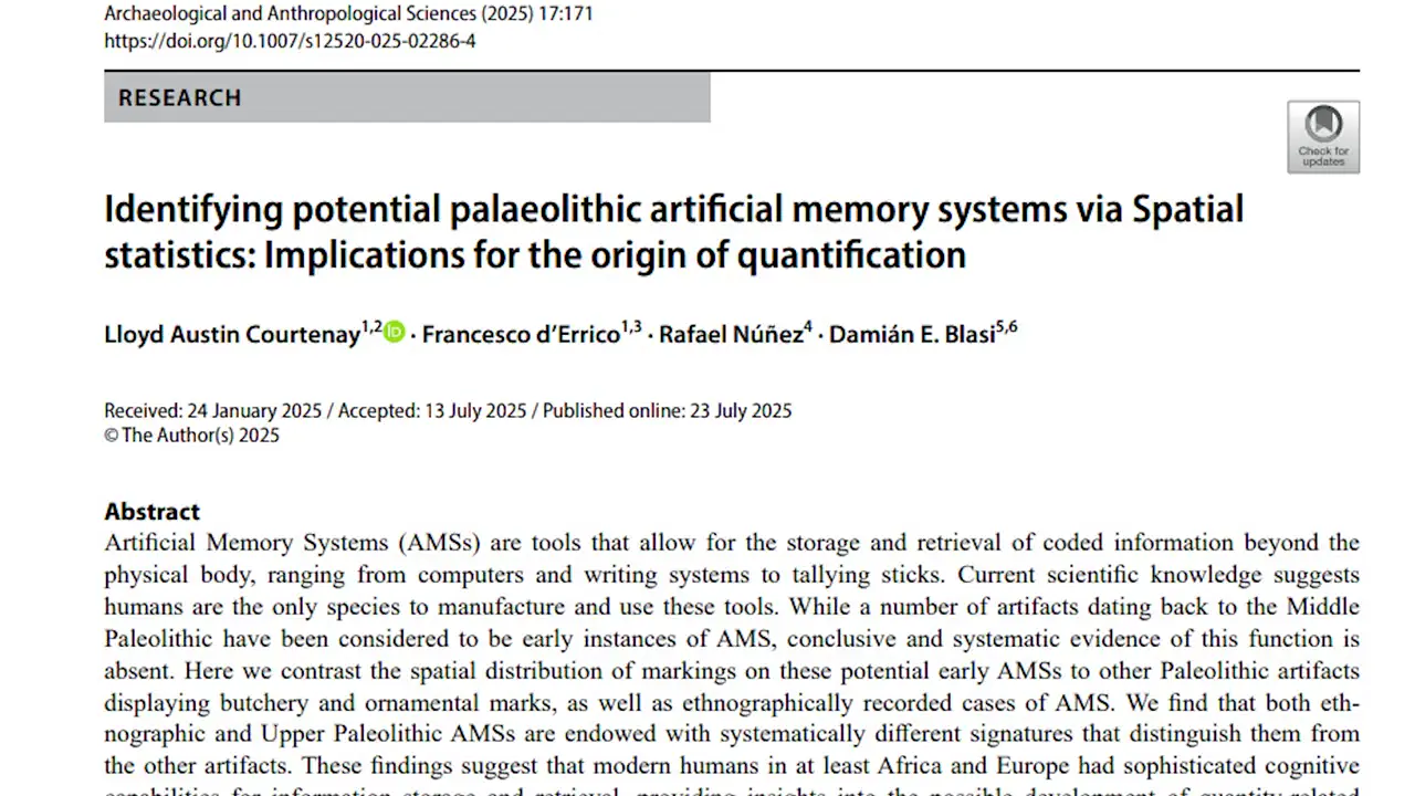
The artifact dates to the middle Magdalenian (Magdalenian III), approximately 14,000 to 15,000 years before present, and belongs to a broader tradition of engraving at the site [6] [V2]. Bone and antler were standard worked materials in Magdalenian technology, providing the cultural and technical context for such pieces [5]. The site lies in the Vienne valley of western France, part of a cluster of Early and Middle Magdalenian caves and rock shelters in the region [7].
Their content references Dacian civilization directly, including names of known Dacian kings alongside Dacian toponyms and hydronyms [9]. A 2026 reassessment by Aurora Petan, published in Antiquity as “A possible Dacian royal archive on lead plates,” argues the corpus may constitute a genuine Dacian royal archive — a striking claim given that the Dacians, who ruled present-day Romania roughly two millennia ago and alarmed Rome with their gold wealth, left virtually no writing of their own [8]. The authenticity question remains deeply contested, however. Scholars have historically classified the plates as forgeries largely because they display a “brand-new appearance” with no traces of corrosion — highly unexpected for lead purportedly buried underground for two thousand years — compounded by their unknown origin. The accompanying narrative that in 1875 gold originals were melted down in a Romanian nail factory to fund a prince’s castle, with lead copies made beforehand, appears only in popular media rather than in documented historical record [V3].

Dating & Chronology
A spread of nearly tenfold between the lowest and highest values strongly suggests non-age factors are driving variability [V4]. The claims have nonetheless circulated through popular media framing the pyramid as potentially “tens of thousands of years” old, echoing earlier debates like the Sphinx water erosion hypothesis about pre-dynastic construction [10].
Bioarchaeology & Ancient DNA
Penghu 2, the upper portion of a right femur, and Penghu 3, a right tibia, are among the most striking Denisovan fossils ever recovered, identified not through ancient DNA but through palaeoproteomic analysis of bone collagen [12] [V5]. Morphologically, these two leg bones rank among the largest known from any Pleistocene Homo individual.
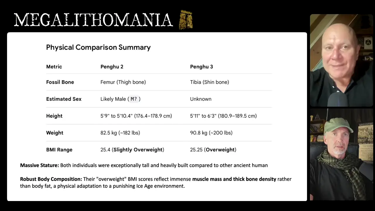
Dated to roughly 43,000–45,000 years ago, the Penghu leg bones represent some of the latest-known Denisovans, placing them near the very end of the group’s existence [V5]. Their significance is amplified by geography: the Penghu Channel lies approximately 4,000 km southeast of Denisova Cave and roughly 2,000 km southeast of the Xiahe mandible site, extending the known Denisovan range deep into East Asia [11]. Notably, the same channel deposits yielded Penghu 1, a male mandible independently confirmed as Denisovan through ancient protein analysis, making the Penghu Channel a multi-specimen Denisovan locality that complements rather than overlaps with the leg-bone study.
Architecture & Monuments
The Neolithic settlement at Göbekli Tepe sustained itself through a rainwater harvesting system, in which carved channels fed cisterns cut directly into the site’s bedrock [14] [13]. Most detailed specifications describe a covered water channel originally topped with limestone slabs to keep the water clean, and a large basin—approximately 3 metres deep and 8 metres in diameter, lined with slabs held down by ballast stones—that went through multiple phases of use before being filled with worked stone; however, these measurements derive from a single popular-media account without corroborating primary excavation data [V6]. Klaus Schmidt reported that several such bedrock cisterns collectively held at least 150 cubic metres of water, while additional pits on the site’s western slope may also have served as rainwater collection features, though their precise date remains uncertain.
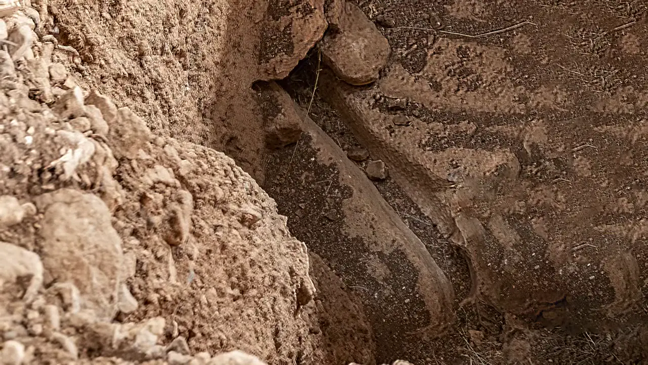
The presence of a managed water supply has become key evidence in recent scholarship arguing that Göbekli Tepe was not solely a ritual sanctuary but also a residential settlement, situating the site within a broader Pre-Pottery Neolithic tradition across Upper Mesopotamia where engineered cisterns helped communities survive in arid or seasonally water-stressed environments. [13]
On Menkaure’s Pyramid, the Great Breach — a large gash scarring the monument’s northern face and exposing its internal structure — can now be dated through documentary evidence bracketing its creation to between 1639 and 1792 [V7]. These records support framing the breach not as medieval demolition but as a 17th-century treasure hunt — an opportunistic attempt to locate the pyramid’s original entrance, described as “a crime of opportunity made by people already dismantling Menkaure’s casing stones”.
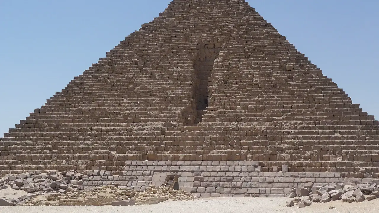
The interpretation, however, faces complications. Proposed causal link to the prior discovery of Khafre’s burial chamber is not independently corroborated beyond a single source [V7], and the 1639 terminus rests on the negative evidence of Greaves’ silence, which is not unambiguous since early modern travel writers sometimes described monuments in summary fashion. Eighteenth-century accounts by De Maillet (1735) and Savary (1785/86), which fall within the bracketed window, could potentially refine the date if consulted in full [15].
In Brief
The Chinese ethnonym Xiongnu has been formally reconstructed in two competing scholarly systems: Wang Li renders Old Chinese as xiuoŋ-na, while Zhengzhang Shangfang proposes qhoŋna [17]. In Modern Standard Mandarin the term is romanized in pinyin as xiōngnú with IPA [ɕjuŋnu] [16], though popular accounts often approximate the ancient pronunciation as something like “honnu,” “hungu,” or “hungai” [V8]. The term subsequently entered Greek and Sanskrit in forms resembling “Chonai” or “Huna,” likely diffused through Greek merchants active around the Caspian region.
Although the Xiongnu and the European Huns share linguistic roots, scholars caution that “Hun” functioned primarily as a political designation in Central Asian contexts rather than as evidence of direct ethnic continuity [V8]. At least one genetic marker does appear to link some members of the original Xiongnu population on the eastern steppe to later Huns who invaded the Roman Empire. The mid-4th-century CE expansion of Huna peoples from Central Asia coincided with drought and political upheaval across the Eurasian steppe. Separately, the title chanyu (or shanyu, 單于) was borne by the ruling Luandi clan of the Xiongnu during the Qin (221–206 BC) and Han (206 BC–220 AD) dynasties and was later extended by Chinese writers to Tujue, or Turkic, leaders [18].

The southwestern Amazon once supported a civilization of millions, overturning long-standing assumptions about the rainforest’s carrying capacity. This dramatic revision replaces the earlier estimate of roughly 60,000 inhabitants at a maximum density of 1.5 people per square kilometer [19]. The revised numbers were produced by combining LiDAR and satellite remote sensing with archaeological data and advanced statistical modeling rather than direct census evidence.

Basis for these estimates is a landscape dense with monumental construction. Over 20,000 geometric earthworks — ditches, mounds, and enclosures — have been documented in southwestern Amazonia, with recent surveys adding nearly 400 previously unknown structures. [19] Inhabitants cultivated maize, squash, sweet potatoes, and chili peppers, and deliberately planted groves of Brazil nut and palm trees. Broader estimates for the precolonial Amazon as a whole suggest a total population of 8 to 10 million, indicating that anthropogenic landscape modification extended well beyond the earthwork zones.
Sources
- finds | The Tepe Telegrams - WordPress.com
- Göbekli Tepe: A Neolithic Site in Southeastern Anatolia
- Yaxuná is a treasure off Yucatán’s beaten path
- Xibalba Meaning: The Maya “Place of Fright” Explained
- Magdalenian cultures | Anthropology | Research Starters - EBSCO
- La Marche (cave) - Wikipedia
- Socio-economic dynamics of Magdalenian hunter-gatherers - PMC
- A possible Dacian royal archive on lead plates | Antiquity …
- A possible Dacian royal archive on lead plates | Antiquity …
- Sphinx water erosion hypothesis
- A male Denisovan mandible from Pleistocene Taiwan
- Denisovans towered over their contemporaries and …
- An immense mystery older than Stonehenge
- Göbekli Tepe
- Early descriptions of the Pyramids by De Maillet (1735) and …
- Xiongnu = Huns? | History Forum
- Xiongnu
- Chanyu - Wikipedia
- Over 20000 precolonial earthworks in the Southwest …
Videos
V1. MegalithomaniaUK — “Underground Chamber Detected and New Excavations 2026 | Megalithomania” V2. Timeless with Fred Snyder — “15k year old Magdalenian Writing | Ice Age Europe” V3. Dark5 Ancient Mysteries — “The “Time-Traveling” Mammoth: 5 Unexplained Artifacts That Only Survive in Photos” V4. Michael Button — “We Might Be Completely Wrong About the Great Pyramid” V5. MegalithomaniaUK — “Denisovan Revelations and Taş Tepeler Update | Andrew Collins | Megalithomania” V6. The Prehistory Guys — “Inside the Excavations: Göbekli Tepe As You’ve Never Seen It” V7. History for GRANITE — “The False Story of Pyramid Destruction” V8. The Historian’s Craft — “The Mysterious Alchon & Kidarite Huns of Late Antiquity - The Huns Who Invaded India”
Keep exploring
Every site on this page sits on the globe, and the people who research them are on the Discord.
3D Globe · Sites by country · Story Archive · Research Library · Weekly Journal · Search