

Week of August 10: 1,240-Ton Baalbek Monolith Found, Yukon Horse DNA Persists, and More
A second monolith weighing approximately 1,240 tons has been identified in the western quarry at Baalbek, distinct from the Stone of the Pregnant Woman. Sedimentary ancient DNA from Yukon's Klondike region detected genetic traces of woolly mammoth and North American horse persisting as much as 7,000 years into the Holocene beyond the last macrofossil evidence. At Göbekli Tepe, new excavations uncovered rectangular domestic buildings, while a joint Chinese-Turkish venture began digging at the Pre-Pottery Neolithic site of Yoğunburç.
A second monolith weighing approximately 1,240 tons has been identified in the western quarry at Baalbek, distinct from the Stone of the Pregnant Woman. Sedimentary ancient DNA from Yukon’s Klondike region detected genetic traces of woolly mammoth and North American horse persisting as much as 7,000 years into the Holocene beyond the last macrofossil evidence. At Göbekli Tepe, new excavations uncovered rectangular domestic buildings, while a joint Chinese-Turkish venture began digging at the Pre-Pottery Neolithic site of Yoğunburç.
New Excavations & Fieldwork
The 2025 dig season, led by Dr., has uncovered rectangular buildings dating to a later phase when T-shaped pillars were less commonly used, featuring pillars up to roughly 2 metres high — mostly undecorated, compared with the oval buildings’ approximately 20-metre diameter and 5.5-metre decorated pillars [V1].
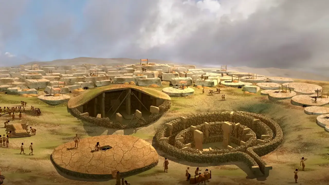
These rectangular buildings are reshaping how researchers understand the site. Their interior arrangements suggest domestic rather than ceremonial use, and there is a clear spatial link with cereal grinding and standardised grinding tools on terraces around the oval buildings [V1].
A second monolith weighing approximately 1,240 tons has been identified in the western quarry at Baalbek, distinct from the better-known Stone of the Pregnant Woman (Hajar al-Hibla) [V2] [1].
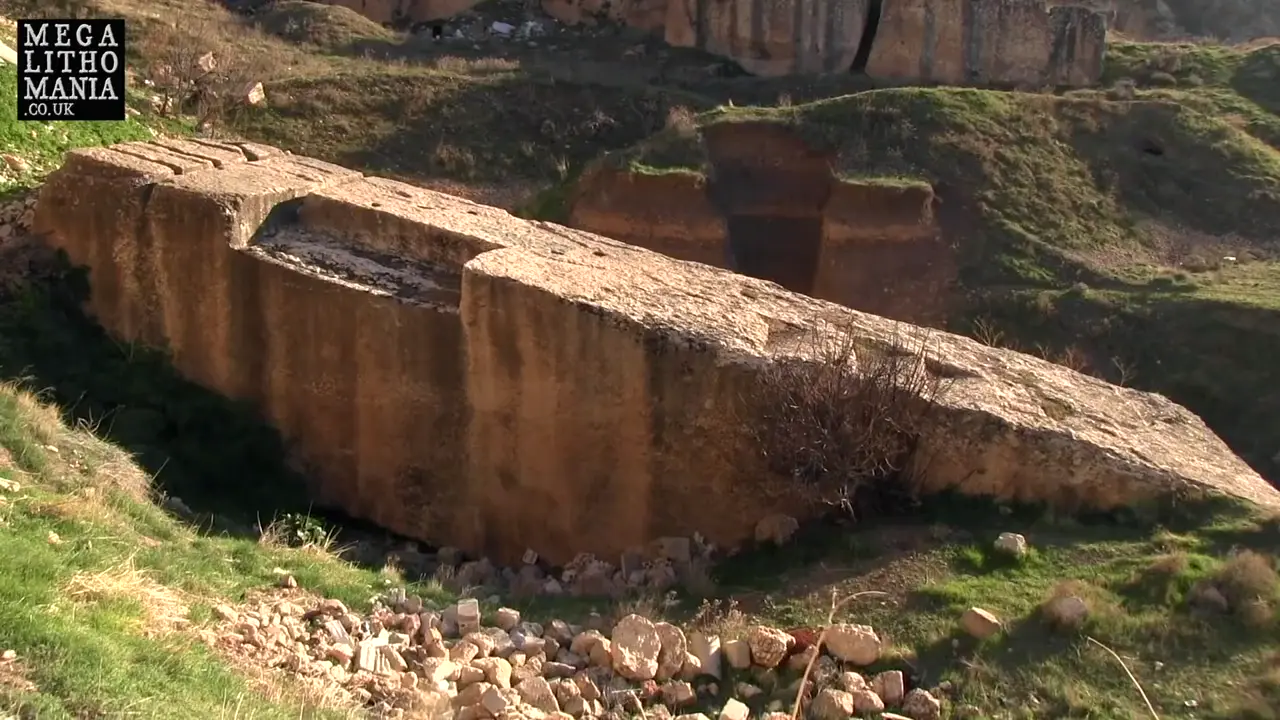
Some researchers have suggested the 1,240-ton monolith may have been deliberately left as a marker of a sacred spot tied to the temple’s origins. An archaeological inspection of the quarry site in 2014 documented a large monolithic block measuring 19.60 × 6 × 5.5 meters, estimated at roughly 1,650 tons at an altitude of about 1,170 meters [2].
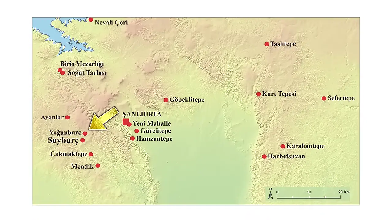
Excavations have begun at Yoğunburç, a Pre-Pottery Neolithic site within the Taş Tepeler project near Şanlıurfa, Turkey [V3] [3]. Spanning roughly 22 acres, the settlement rivals Göbekli Tepe in scale, ranking it among the largest Neolithic sites under investigation in the region. The dig is a joint Chinese-Turkish venture and represents China’s first archaeological excavation project in Türkiye.
Artifact Discoveries
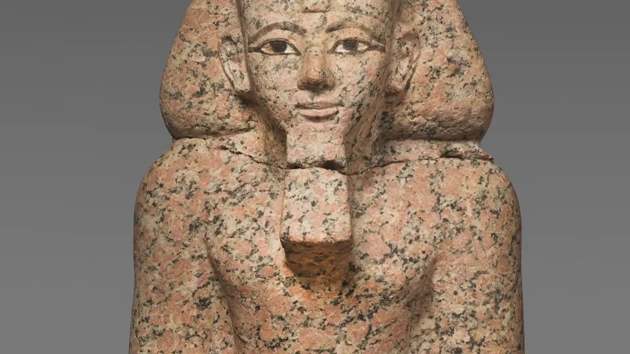
The erasure of Hatshepsut from Egypt’s monumental record, long attributed to a vengeful purge by her stepson Thutmose III, is now understood as a selective and gradual political campaign rather than a single coordinated act of destruction [V4] [4]. Building sequence evidence from Karnak, documented by Charles Nims in 1966, establishes that Hatshepsut’s Year 17 inscription remained intact when Thutmose III constructed his festival hall around Years 23-24 of his reign, providing a terminus post quem for the erasure campaign.

Dating & Chronology
To grasp what “a thousand years earlier” actually means, the Sardinian context itself helps. The only firm anchor is the Roman conquest of Sardinia in 238 BC, which sets a hard terminus for the pre-Roman Nuragic world [V5].
Remote Sensing & Technology
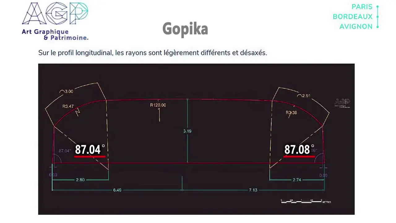
The neighboring Vadathika chamber tells a similar story, with a barrel-vault ceiling radius that varies between 2.02 m and 2.25 m, long side walls at roughly 87°, and short end walls at 89° [V6].
Taken together, these measurements describe craftsmanship operating at centimeter-scale variation—masterful by any human standard, but unmistakably not machine-perfect [V6]. The chambers themselves, with floor areas ranging from roughly 42 to 84 m², are the oldest surviving rock-cut caves in India, hewn during the Maurya Empire around 322–185 BCE in the Makhdumpur region and long associated with the sacred spaces of the Ajivika monks. The scanning work itself relied on survey-grade instruments such as the Leica ScanStation P40 and BLK2GO handheld scanner, an established approach for capturing high-resolution 3D records of complex cave interiors [5].
Bioarchaeology & Ancient DNA
A landmark 2021 study by Tyler J. Murchie and colleagues, published in Nature Communications under the title “Collapse of the mammoth-steppe in central Yukon as revealed by ancient environmental DNA,” analyzed sedimentary ancient DNA (sedaDNA) preserved in loessal permafrost silts from four sites in the Klondike region of West Central Yukon, Canada [6] [V7] [8]. The sedaDNA record spans approximately 30,000 to 4,000 calibrated years before present, and within it the researchers identified a lingering signal of Equus sp. (North American horse) and Mammuthus primigenius (woolly mammoth) at multiple sites—genetic traces persisting as much as 7,000 years into the Holocene beyond the last macrofossil evidence for these animals [7]. The study was promoted through NSERC communications with headlines framing the findings as mammoths and Yukon wild horses surviving thousands of years longer than previously believed.
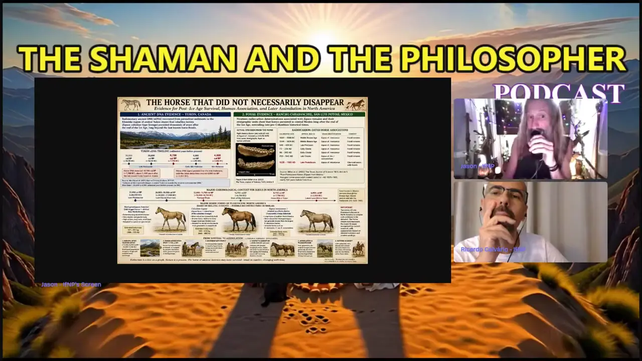
The same sedaDNA record documents substantial ecosystem turnover between approximately 13,500 and 10,000 cal yr BP, marked by the rise of woody shrubs and the disappearance of the mammoth-steppe [10]. Notably, the late-survival signal for horses and mammoths currently exists only in sedaDNA data, with no independent macrofossil or radiocarbon corroboration yet documented. A companion study by Monteath et al. (2023) in Quaternary Science Reviews provides 41 radiocarbon dates and multiproxy analysis from the Lucky Lady site, narrowly anchoring the collapse of the mammoth steppe to beginning ca. 13,480 cal yr BP with shrub tundra established by ca. 13,210 cal yr BP [9].
Architecture & Monuments
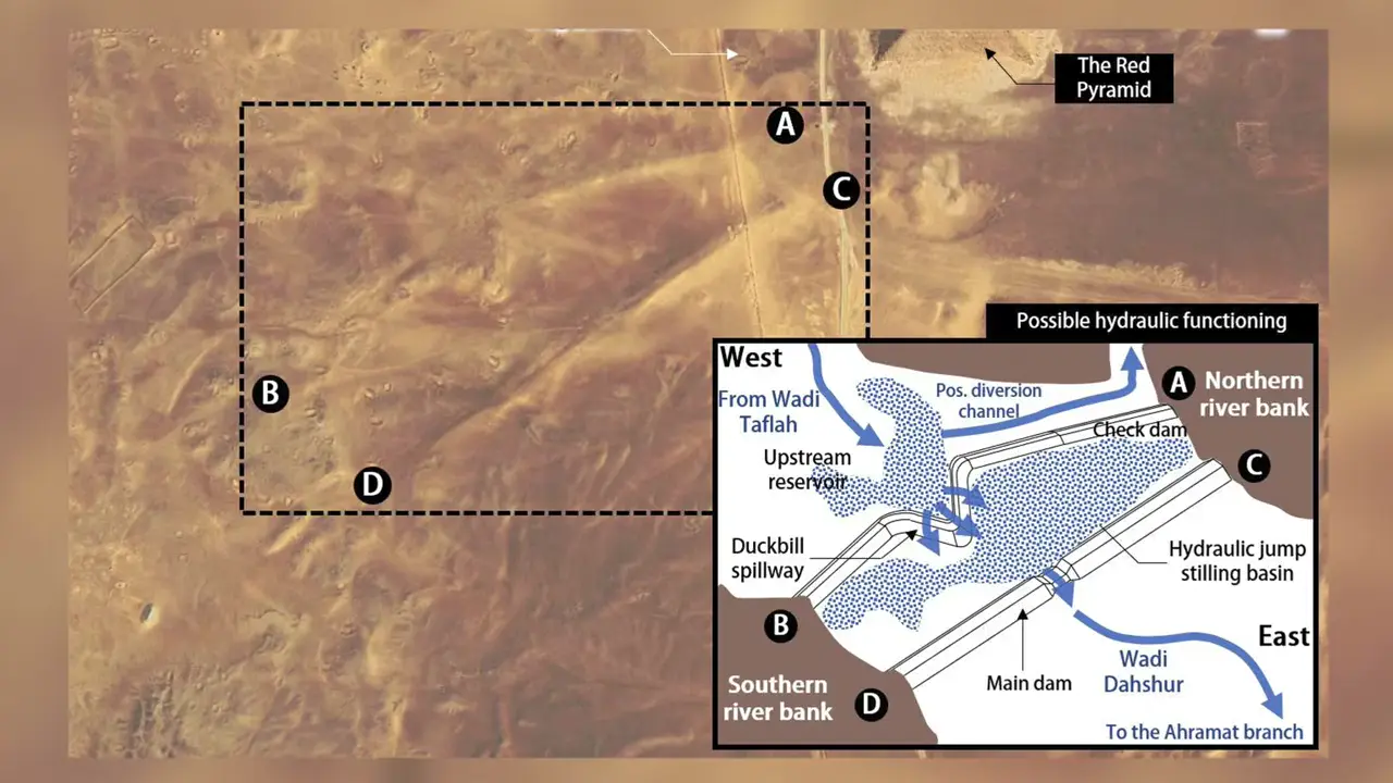
A study published in Heritage Science by X. Landreau reinterprets two structures in Wadi Dahshur — running roughly 40 metres southwest of Sneferu’s Red Pyramid — as the remains of an ancient hydraulic system [11]. The westernmost dam features a large zigzag section interpreted as a possible “duckbill” spillway, and the study identifies a third hydraulic element, a separate water diversion feature [V9].
Worth flagging: the paper itself uses the cautious qualifier “possible” in its title, while several popular outlets present the dam identification as established fact — a notable gap between the study’s framing and its media coverage [11]. The description of the structures as “earthen rock embankments” likewise rests on morphological inference rather than excavation [V8].
In Brief
When Filippo Biondi’s team announced that radar data revealed what he described as a “sprawling subterranean citadel” beneath the Giza Plateau, complete with a potential second sphinx buried under an anomalous sand mound, mainstream outlets transformed the hedged hypothesis into apparent discovery [V11]. The New York Post ran the headline “Second Sphinx buried under sand suggests mega structure below the pyramids of Giza,” presenting the claim affirmatively with language like “researchers detect”, while the Daily Mail’s report traced not to a peer-reviewed publication but to the Matt Beall Limitless podcast.
Compounding the skepticism, the area where this second sphinx is predicted to lie falls within one of the most heavily excavated archaeological sites on Earth, not an unexplored stretch of desert, and published satellite imagery of the mound reportedly reveals only a “lump” rather than a recognizable sphinx form [V10].
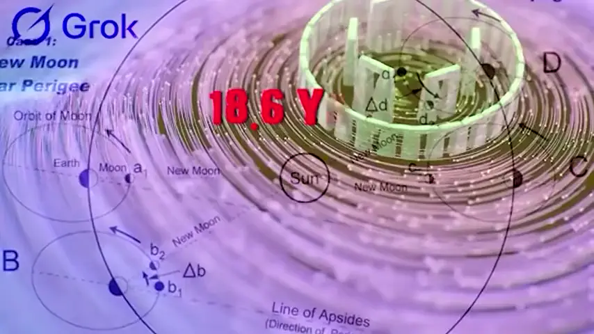
The 56 Aubrey Holes ringing Stonehenge, first noted by the antiquarian John Aubrey in 1666, have long been suspected of encoding astronomical cycles. The leading interpretation holds that the count of 56 closely approximates three consecutive 18.61-year lunar nodal cycles (3 × 18.61 ≈ 55.83) [12] [V12]. The underlying 18.6-year period is the major lunar standstill — the slow oscillation over which the extreme limits of moonrise and moonset shift [13]. In his 1963 work Stonehenge Decoded, Gerald Hawkins proposed that users could have moved markers between consecutive holes to count off the nodal cycle, effectively turning the circle into a mechanical counter. One more elaborate operational scheme places Sun and Moon markers in holes directly opposite one another, with the Moon marker reset each month, potentially enabling eclipse prediction [14].
However, the lunar interpretation is far from settled. Multiple mutually incompatible theories account for the number 56, including Daub’s 1993 association with a 295,306-day cycle of lunar phases and the suggestion that the holes functioned as a day-by-day counter for the solar year [15]. The Aubrey Holes belong to Stonehenge’s earliest construction phase, predating the surviving sarsen stones, and the Station Stones are thought to have linked solar and lunar cycles to the surrounding burials, embedding cosmological timekeeping within the monument’s funerary landscape. The persistence of competing hypotheses underscores how much remains unresolved about this remarkable ring of chalk pits.
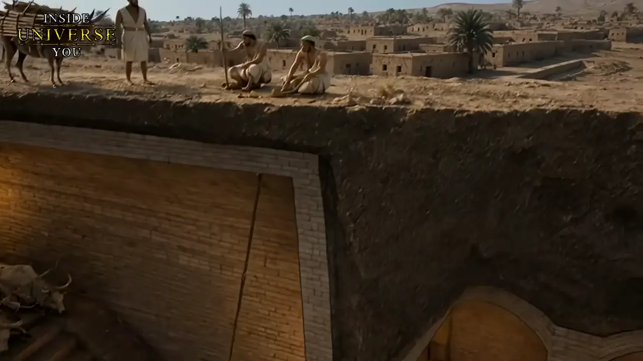
At modern Tell el-Muqayyar in Iraq’s Dhi Qar Governorate, the Great Ziggurat of Ur was built around 2100 BCE by King Ur-Nammu of the Third Dynasty of Ur as a monumental stairway to the heavens, dedicated to Nanna, the Sumerian moon deity and patron of the city [17] [16]. The first stage alone incorporated roughly seven million mudbricks and 720,000 fired bricks, with a mud-brick core faced in baked bricks bonded by bitumen—a naturally occurring petroleum tar used as waterproof mortar. Weeper holes pierced the baked-brick casing to allow moisture to escape from the core. Although later restored in the 6th century BC by Nabonidus, the last king of Babylon, the ziggurat visible today is largely reconstructed, its current proportions reflecting later interventions as much as Ur III originals.
The most striking feature of the YouTube video ‘SPIRIT in STONE — Egypt’s Oldest Surviving Photographs from 1860–1900’ is its largely silent middle segment: from roughly 02:03 to 17:29 — about fifteen and a half minutes — the audio track contains only background music, with no narration, archaeological facts, dates, site descriptions, methodologies, or artifact details extractable from the audio [V15] [V13] [V14]. According to the video description, this music-only segment likely displays archival photographs of ancient Egyptian monuments, daily life, and landscapes from the 19th century.
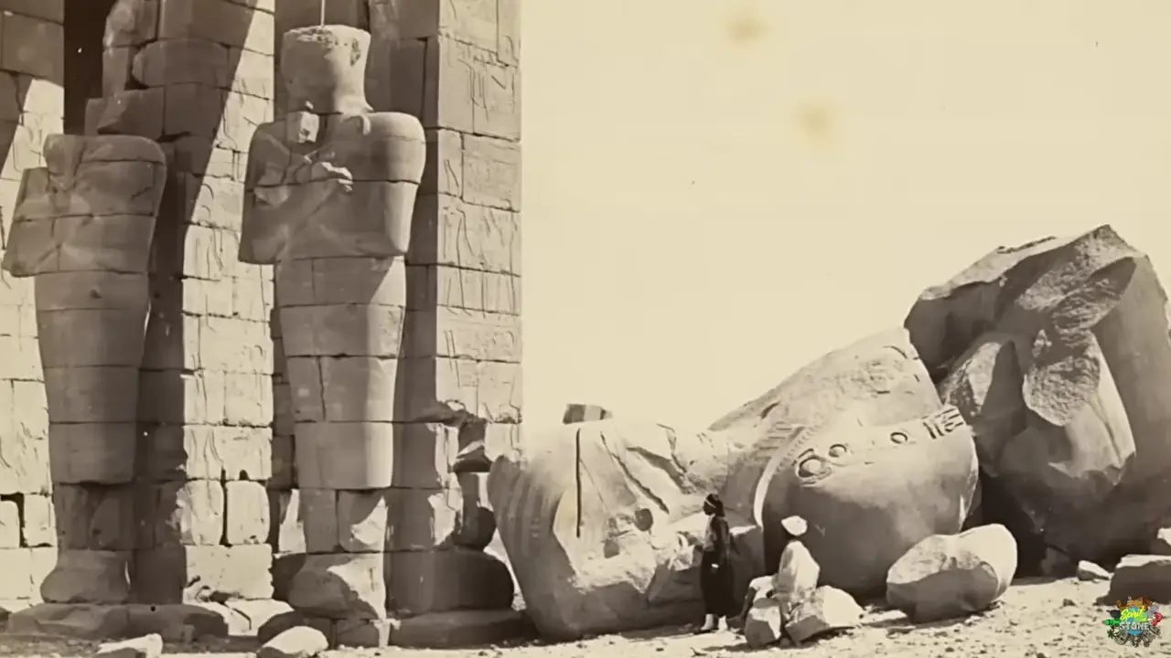
This visual material fits within a well-documented tradition of early photographic documentation of Egypt. An image of the harem gate of Mehmet Ali at Alexandria is described by the University of Chicago’s ISAC publication as “probably the first photograph made in Egypt,” reportedly causing “a sensation when exhibited in Paris” [18]. Getty Images and Alamy further attest to the scale of surviving material.
Two cautions apply: the three transcript excerpts (at t=423, t=720, and t=906) all derive from one YouTube upload and thus provide no independent corroboration [V15] [V13] [V14]. Commercial catalog figures, such as Getty’s 15,028 ‘Egypt 19th Century’ entries, may include duplicates or retouched images re-keyed as historical.
Aboriginal oral traditions preserve a striking memory of the separation of Kangaroo Island—known as “Karta Pintingga,” or “Island of the Dead,” to groups including the Ngarrindjeri, Narungga, and Ramindjeri—from the South Australian mainland [V16]. A central narrative describes the ancestral figure Narungga chasing his wives across dry land to the island before flooding the strait behind them in anger and turning them to stone.
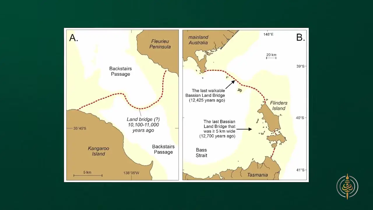
Mainland Aboriginal oral histories corroborate archaeological evidence of long-standing habitation on Karta Pintingga, where Aboriginal people are believed to have remained until roughly 2,000 years ago, when the island’s geographic isolation likely contributed to its abandonment. The tradition continues to resonate today: contemporary Aboriginal artist James Tylor has explored what he describes as the “dark human history” of Kangaroo Island through his series “karta (the island of the dead),” which engages with both Nunga Aboriginal and European Australian perspectives [19].
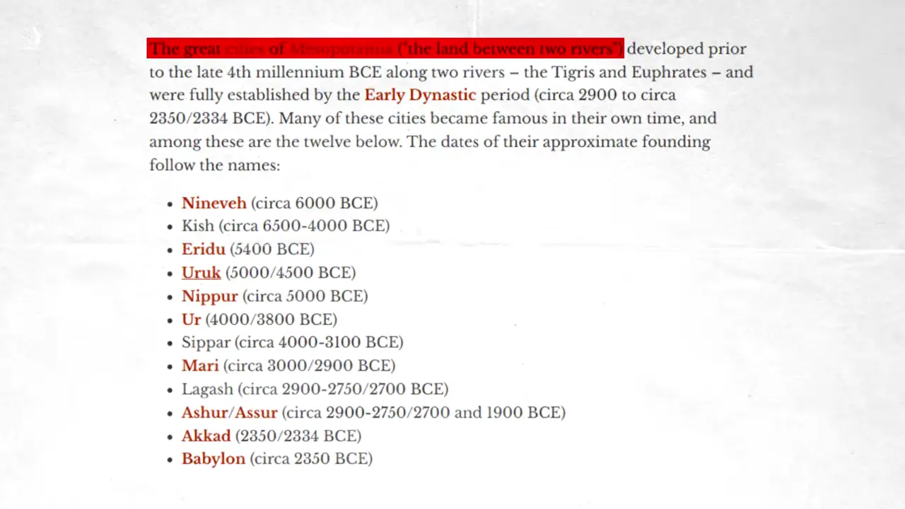
The same independent pattern unfolded simultaneously worldwide. The Indus Valley Civilization (3300–1300 BCE) was characterized by urban planning, baked brick houses, and elaborate drainage systems, with Mohenjo-daro and Harappa each housing 30,000 to 60,000 inhabitants at their peak [20]. Coastal Peru’s Caral/Norte Chico, dating to 3500 BCE, is the oldest known civilization in the Americas and one of at least five “pristine” civilizations developed entirely without external influences. Walled settlements also rose along China’s Yellow River as part of this same independent emergence, while the Neolithic Revolution’s shift from nomadic hunting to sedentary agriculture provided the demographic and economic foundation for this near-simultaneous wave of urbanization across continents.
Sources
- Baalbek Stones - Wikipedia
- Biggest ancient stone block in Baalbek/ancient Heliopolis
- China’s First Archaeological Excavation Project in Türkiye …
- The shattered statues of Queen Hatshepsut - Nature
- 3D cave mapping with handheld and terrestrial laser …
- Collapse of the mammoth-steppe in central Yukon as revealed …
- Ancient DNA suggests woolly mammoths roamed the Earth …
- [2021] Collapse of the Mammoth-steppe in central Yukon as …](http://novataxa.blogspot.com/2021/12/mammoth-steppe.html)
- Relict permafrost preserves megafauna, insects, pollen, soils and pore-ice isotopes of the mammoth steppe and its collapse in central Yukon
- Collapse of the mammoth-steppe in central Yukon as …
- Two possible ancient dams near the Red Pyramid on …
- [Sticky] Stonehenge: Ancient Monument as Cycle Computer
- Stonehenge Major Lunar Standstill
- Aubrey holes - Stonehenge Stone Circle News and Information
- The Aubrey Holes Revisited
- Ziggurat of Ur (article) | Ancient Near East - Khan Academy
- Ur
- Photography and the Early Documentation of Egyptian …
- karta (the island of the dead) - james tylor.
- Indus Valley Civilisation
Videos
V1. Ancient Architects — “NEW EXCAVATIONS Begin at the Göbekli Tepe: Buildings Uncovered!” V2. MegalithomaniaUK — “Baalbek | Mega-Temple of the Gods | Megalithomania Documentary” V3. Ancient Architects — “NEW EXCAVATIONS Begin at the Göbekli Tepe: Buildings Uncovered!” V4. World of Antiquity — “10 Famous Ancient Events That Never Happened” V5. One-eyed giant building walls — “The Ancient Invasion That Split Corsica in Two. 👁️🪨🤯” V6. Curious Being — “I Spent Months Investigating the Barabar Caves. Here’s What I Found” V7. Institute for Natural Philosophy — “The Shaman and the Philosopher - Ep. 36” V8. Ancient Architects — “Mysterious Features at the Red Pyramid Reveal Ancient Engineering!” V9. Ancient Architects — “Mysterious Features at the Red Pyramid Reveal Ancient Engineering!” V10. DeDunking — “Milo Rossi Made Up Data On The 2nd Sphinx miniminuteman Fail” V11. DeDunking — “Milo Rossi Made Up Data On The 2nd Sphinx miniminuteman Fail” V12. Funny Olde World — “AI Analysed Stonehenge | Here’s what I found …” V13. SPIRIT in STONE — “Egypt’s Oldest Surviving Photographs from1860–1900” V14. SPIRIT in STONE — “Egypt’s Oldest Surviving Photographs from1860–1900” V15. SPIRIT in STONE — “Egypt’s Oldest Surviving Photographs from1860–1900” V16. The Cosmic Summit — “Aboriginal Stories Describe a Coast That Drowned 7,000 Years Ago”
Keep exploring
Every site on this page sits on the globe, and the people who research them are on the Discord.
3D Globe · Sites by country · Story Archive · Research Library · Weekly Journal · Search