ANCIENT NERDS
RESEARCH PLATFORM
Explore the ancient world through data, maps, and AI
750K+
Sites
90+
Countries
30+
Empires
20+
Sources
RESEARCH PLATFORM
Explore the ancient world through data, maps, and AI
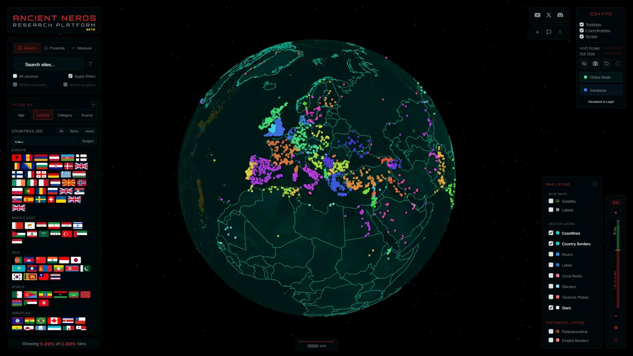
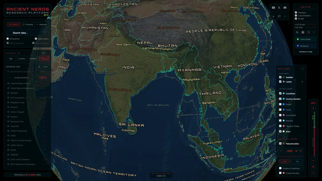
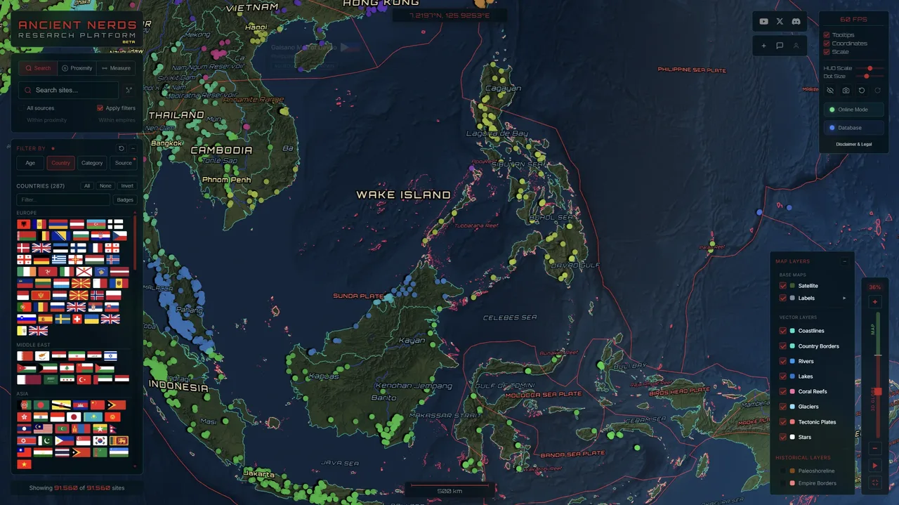
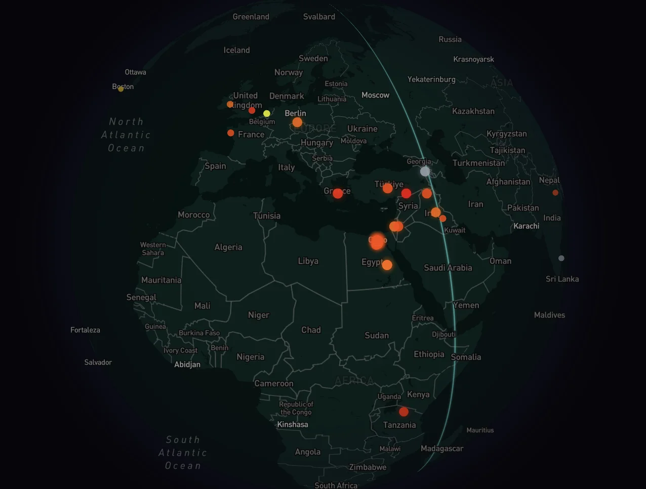
Hundreds of thousands of archaeological sites rendered on a WebGL globe. Rotate, zoom from orbit to street level, switch between satellite and dark mode.
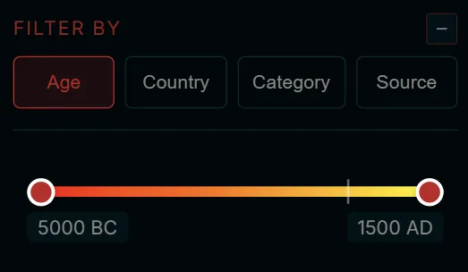
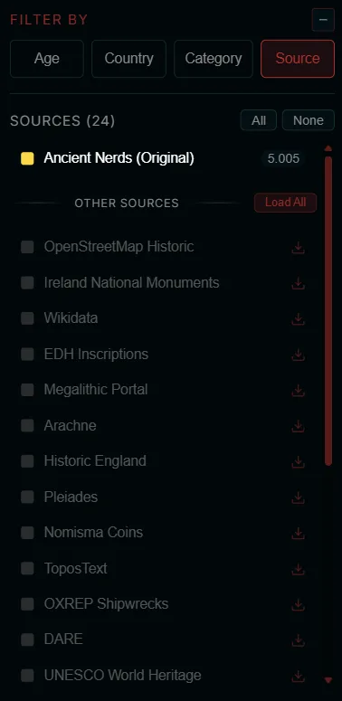
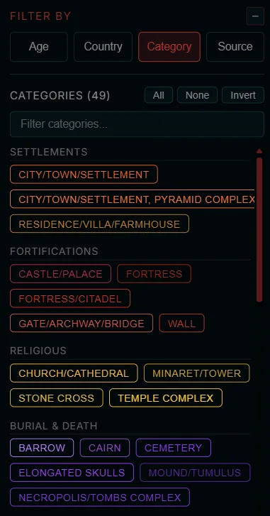
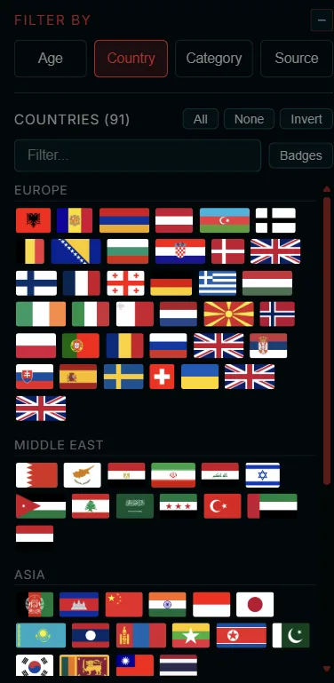
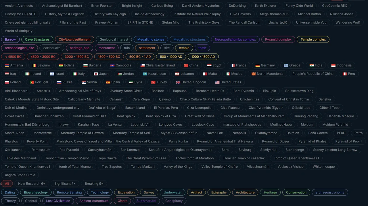
By age, country, category, or data source. Narrow down from 5,000 BC and older to present across 90+ countries and 49 site types.
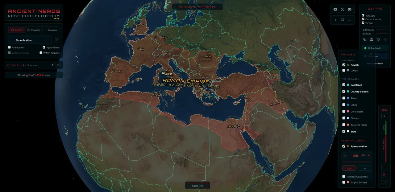
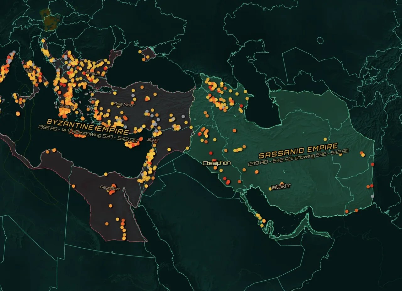
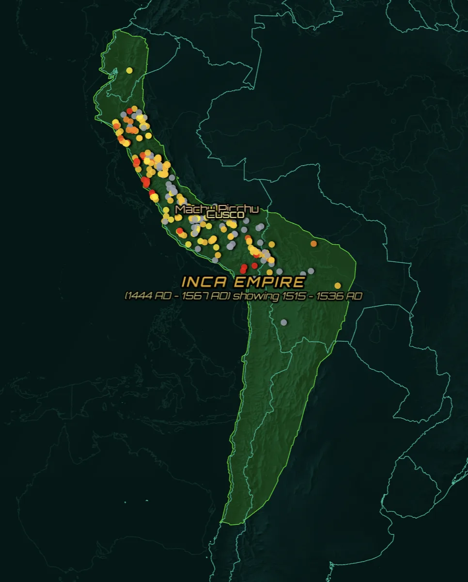
30+ historical empires with animated timeline controls. Roman, Byzantine, Mongol, Inca, and more.
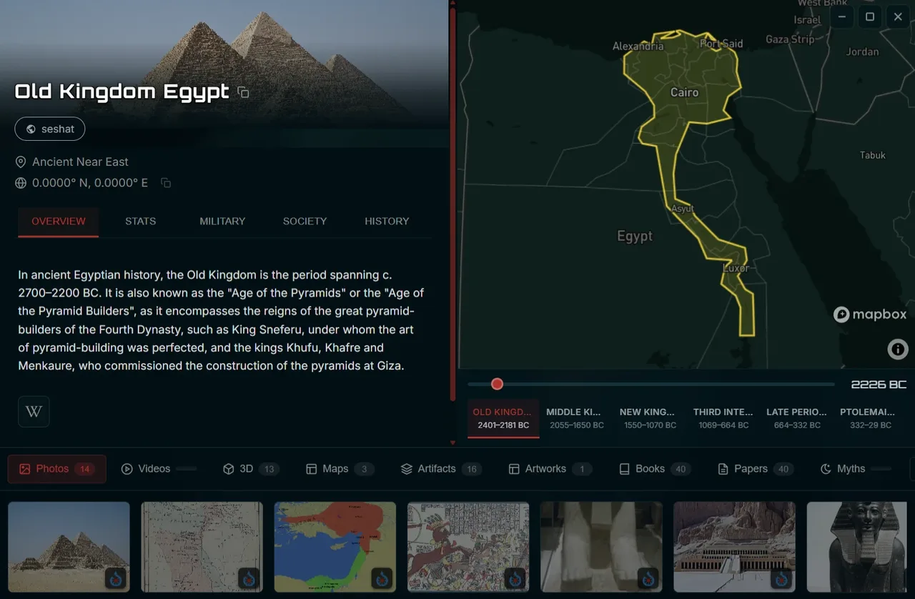
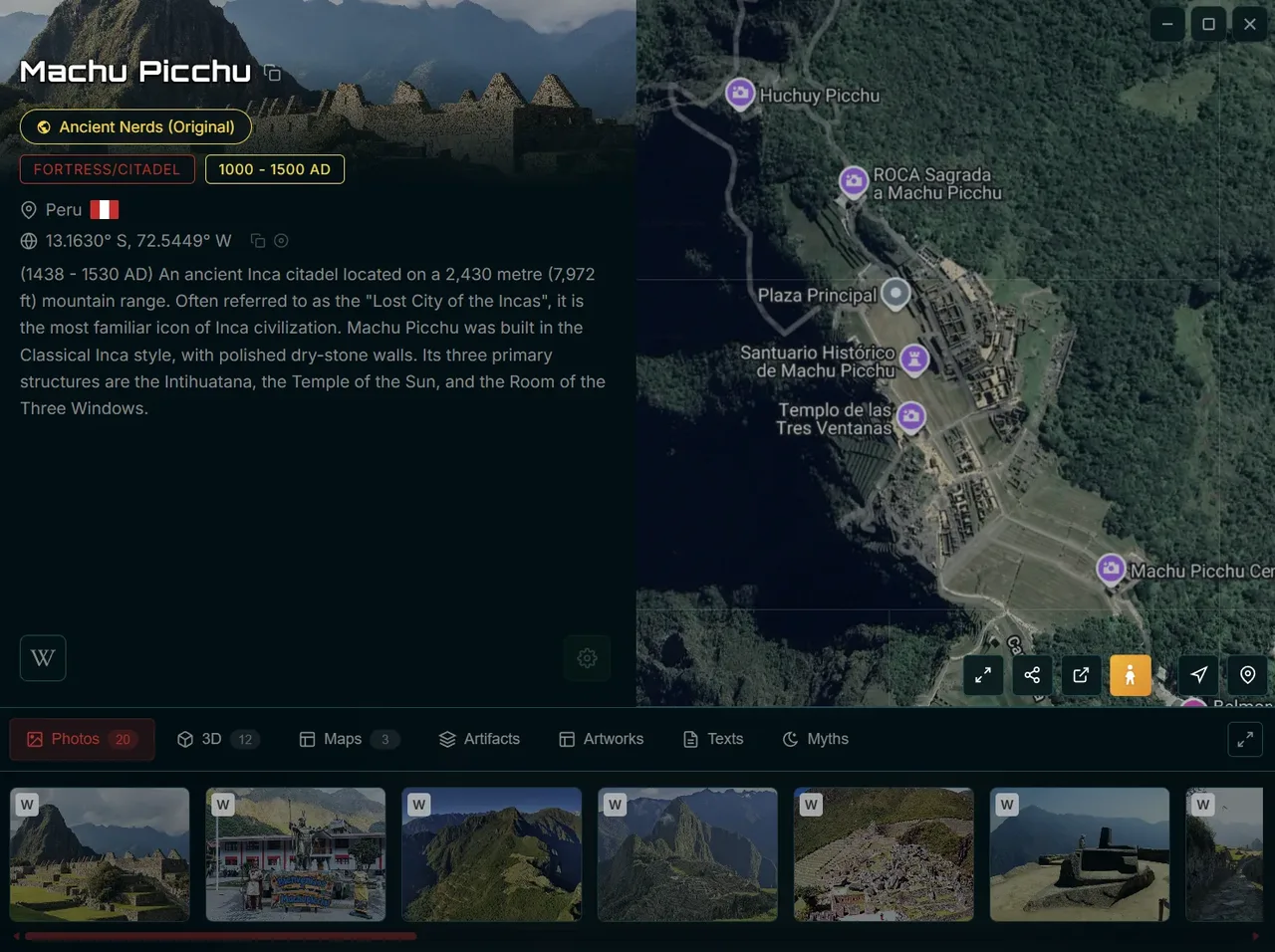
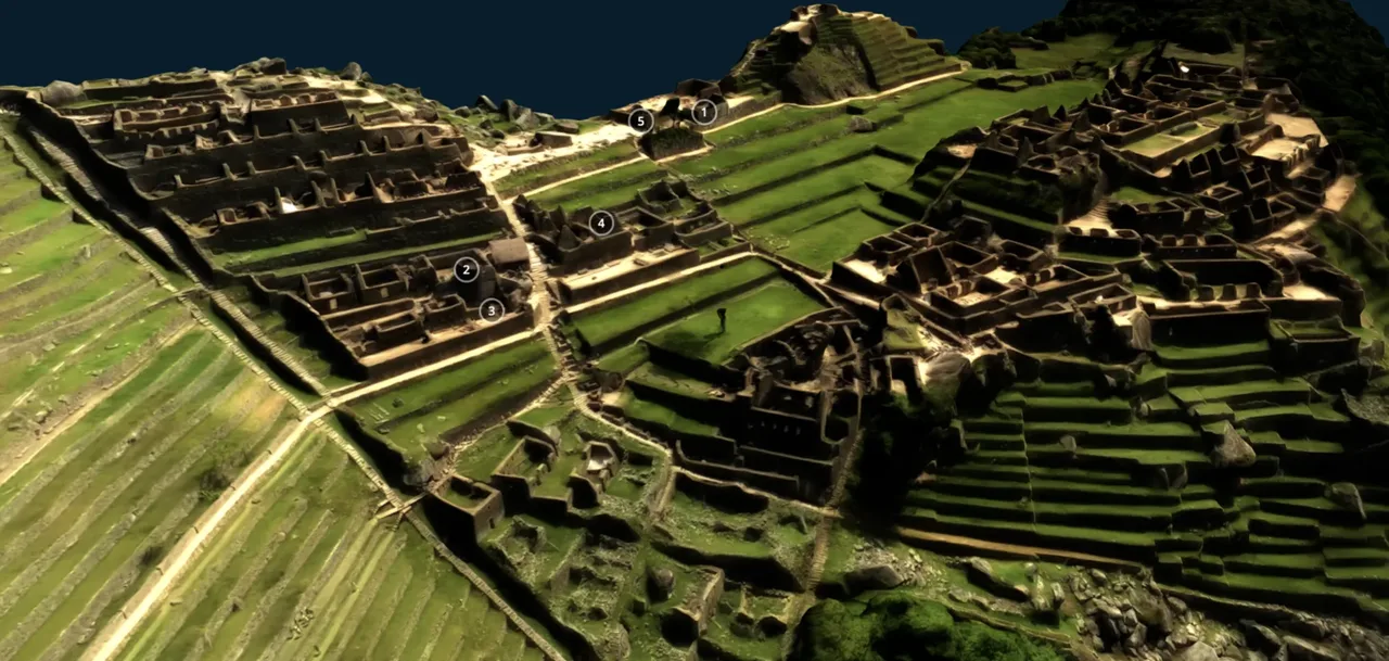
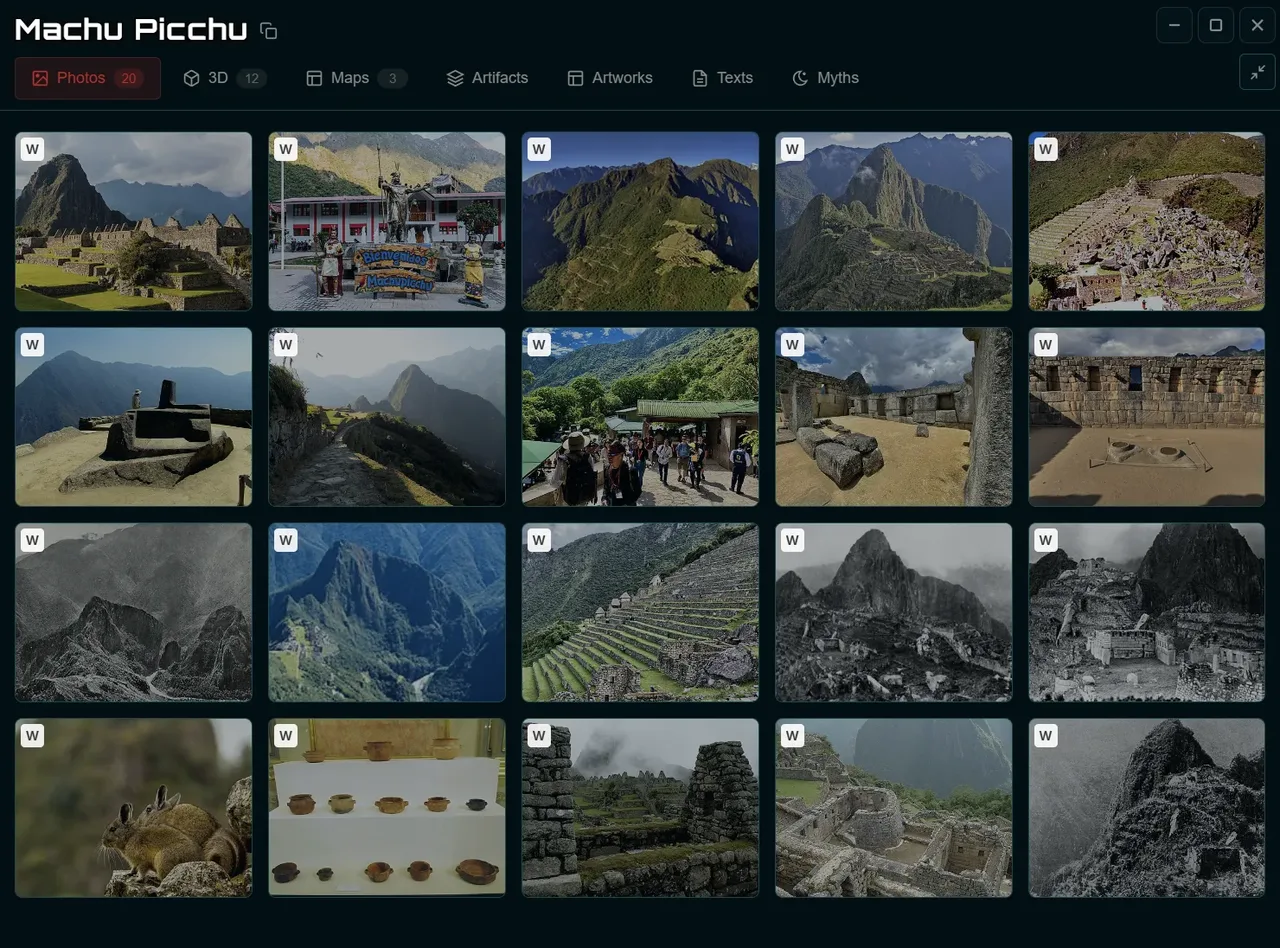
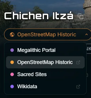
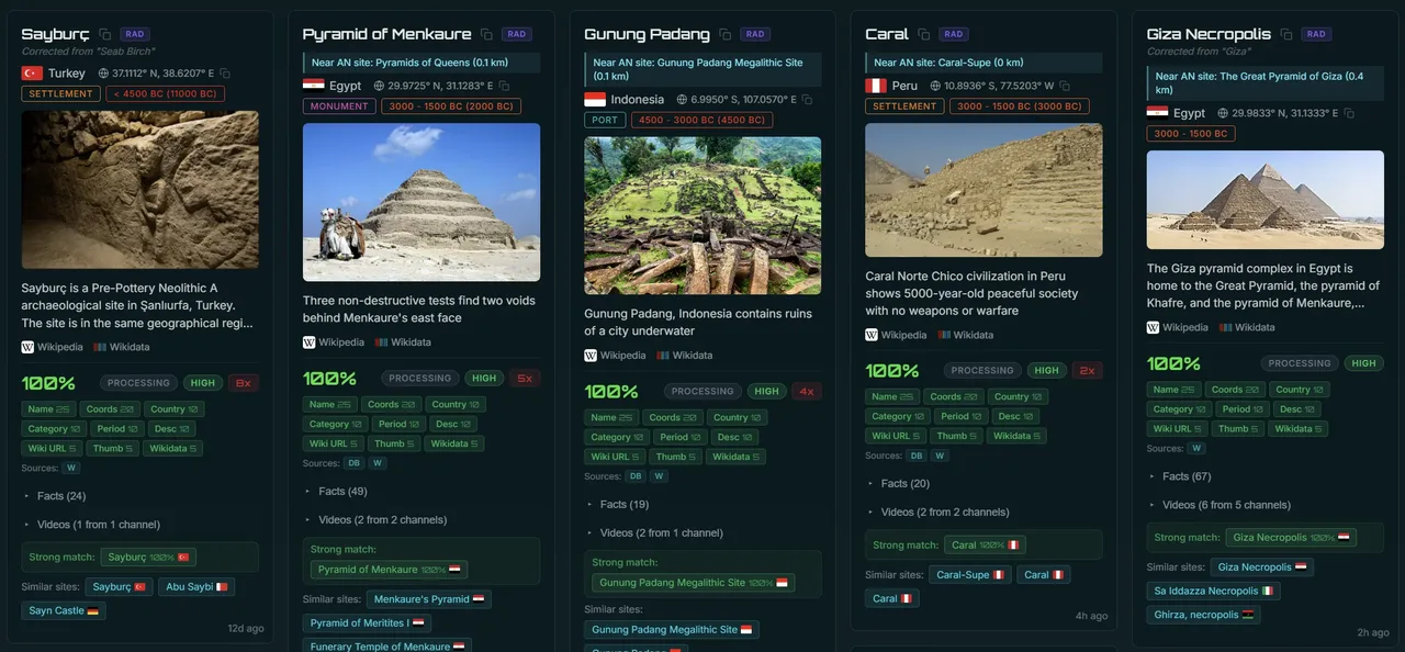
Photos, 3D photogrammetry, historical maps, artifacts, texts, and myths. Cross-referenced across multiple databases.

Your AI archaeology companion. Ask about any site, period, or region. Powered by vector search across the entire database.
CHAT WITH LYRA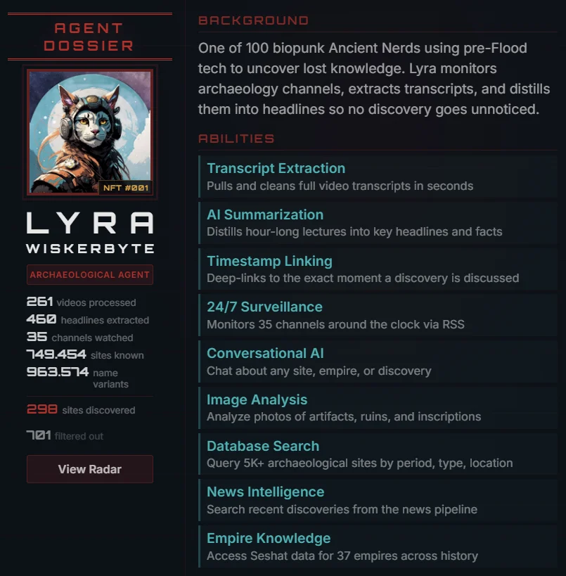
AI-curated discoveries from top YouTube channels. Summaries, site links, and video timestamps.
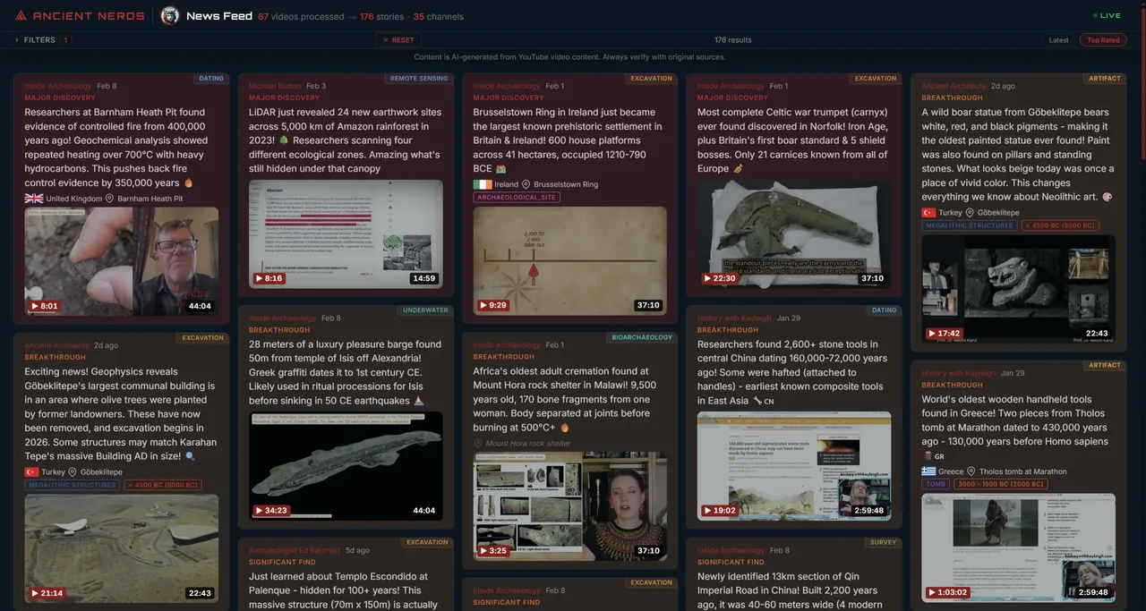
 VIEW NEWS
Track newly mentioned sites from video content. 749K+ known sites cross-referenced in real-time.
 OPEN RADAR
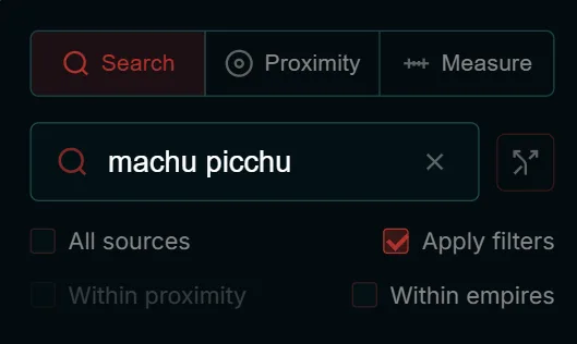
Find any site by name
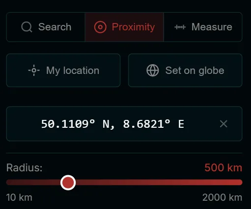
What's near you?
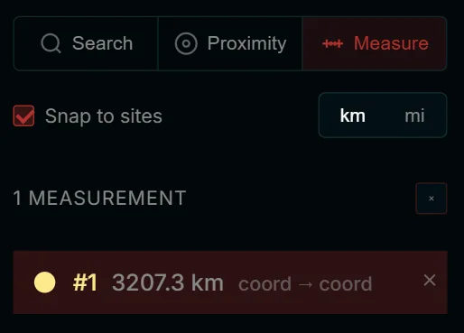
Distance between sites
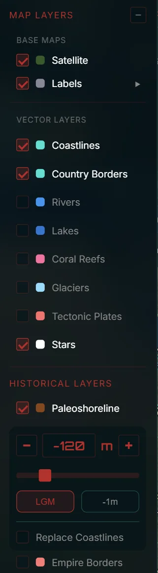
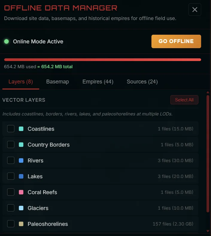
Rivers, reefs, glaciers, tectonic plates
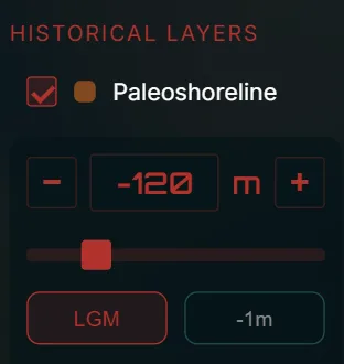
Ice age coastlines
Field-ready PWA
AI-generated deep dives into the week's biggest archaeological discoveries. Sourced, cited, and illustrated.
READ ARTICLES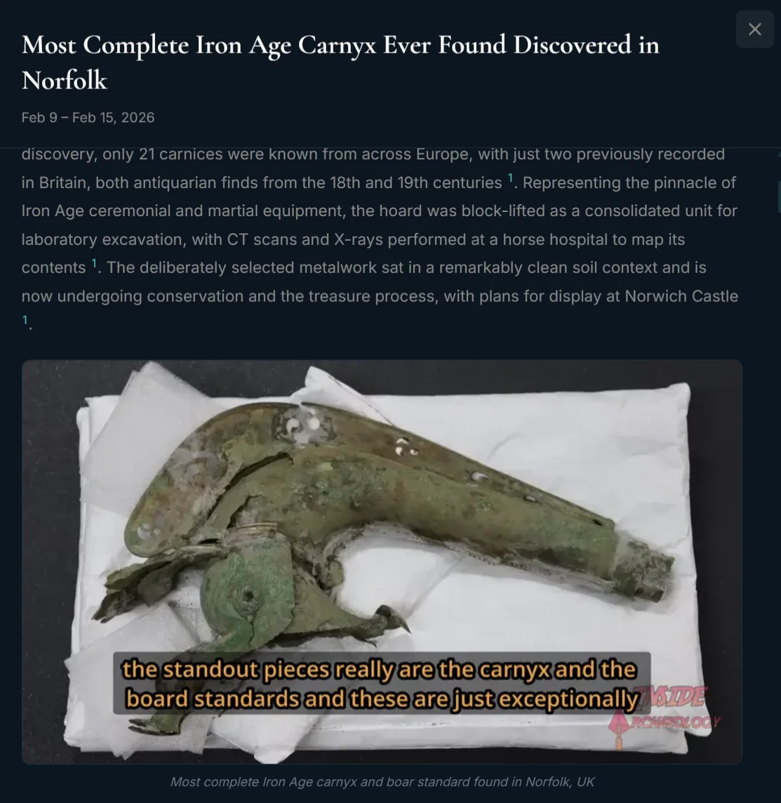
Aggregating the world's archaeological databases into one unified platform.
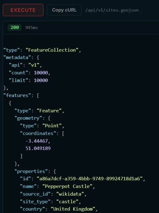
Full read-only REST API for developers. Search sites, query sources, fetch news, and get stats. Interactive explorer with live requests and syntax-highlighted responses.
EXPLORE THE API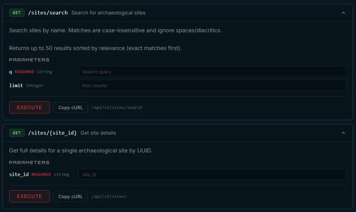
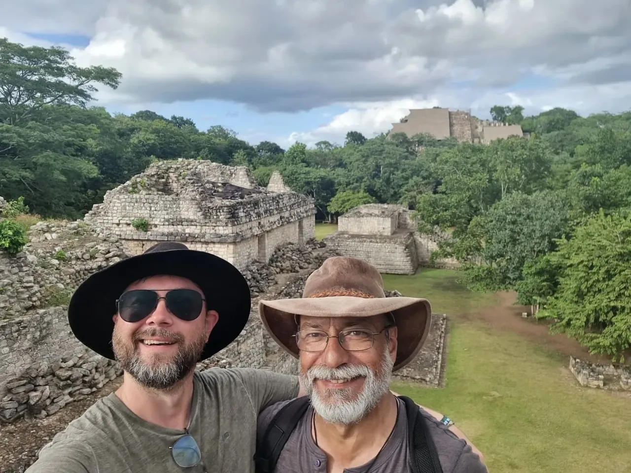
Martin from Germany and Matt from Australia. We've spent years chasing megalithic mysteries and questioning the mainstream narrative of our ancient past.
Polygonal masonry that defies explanation. Precision stonework attributed to "copper chisels." Sites that rewrite timelines. This platform exists because we got tired of scattered data and wanted one place to map it all.
Polygonal masonry that defies explanation. Precision stonework attributed to "copper chisels." Sites that rewrite timelines. This platform exists because we got tired of scattered data and wanted one place to map it all.
A small but growing community of nerds who love ancient history. Share cool finds, geek out over maps, and help us build this thing.
JOIN OUR DISCORD